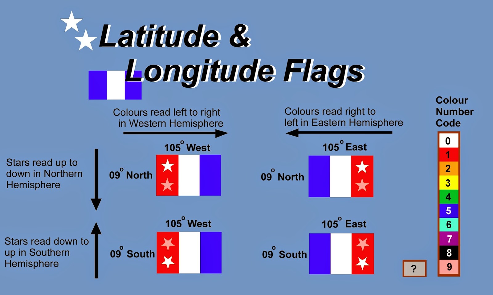
International Geographic Latitude-Longitude Flags are a type of geographic flag. The designs are coded to latitude and longitude. These flags are non-political and scientific in orientation, but any nation can fly any of these flags. The three bars represent longitude while the stars represent latitude. Each colour represents a number:
(0) zero is represented white
(1) one is represented red
(2) two is represented by orange
(3) three is represented by yellow
(4) four is represented by green
(5) five is represented by blue
(6) six is represented by indigo
(7) seven is represented by purple
(8) eight is represented by black
(9) nine is represented by pink
(#?) unknown is represented by grey
Latitude is represented by the two stars and is read according to which hemisphere they represent. In the Northern Hemisphere the stars point upwards and are read downwards, but for Southern Hemisphere flags, the stars point downwards and are read upwards.
Longitude is represented by the three vertical tribars. In the Eastern Hemisphere the colours are read left to right. An easy way to remember is that popular Eastern Alphabets in the Eastern Hemisphere use this orientation like Hebrew, Arabic, and vertical Chinese/Japanese. But in the Western Hemisphere colours are read right to left. Likewise languages that use the Western Roman-Italian Alphabet read left to right, and dominate the Western Hemisphere.
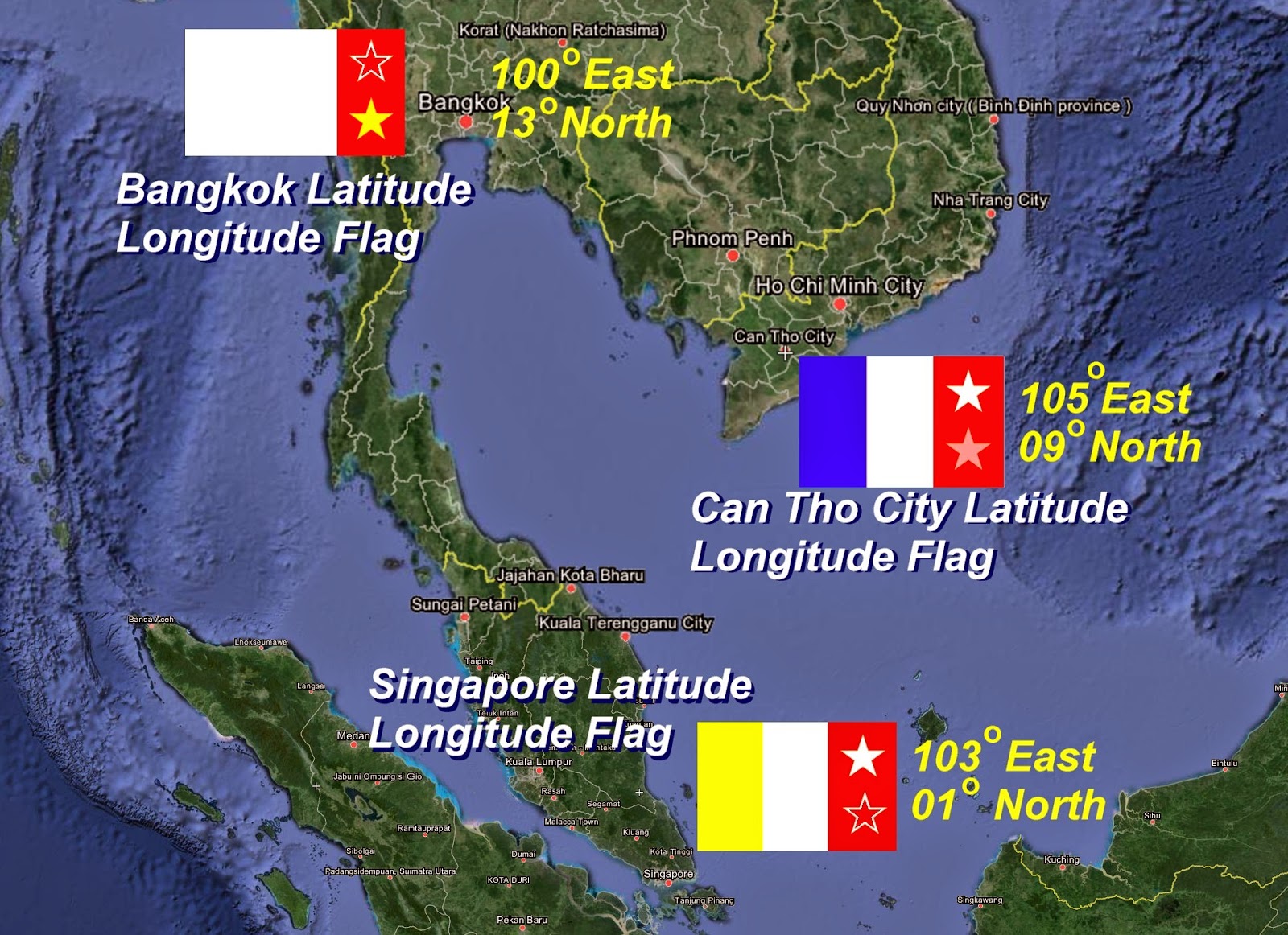
Below is a selected example of three cities with their Geographic Latitude-Longitude flags: Bangkok, Singapore, and Can Tho City.
No comments:
Post a Comment